New study maps bird flu risk across Denmark week by week
A detailed spatiotemporal study shows how migration, water habitats and carcasses shape the spread of highly pathogenic avian influenza.
Tracking bird flu through space and time
A new study examining the spread of highly pathogenic avian influenza (HPAI) in Denmark has provided one of the clearest pictures yet of how wild birds influence the disease’s movement across a landscape. Using a sophisticated spatiotemporal model, researchers mapped infection risk week by week, revealing clear seasonal patterns and geographic hotspots.
The work focuses on how infection circulates within wild bird populations rather than spillover from poultry. By combining bird abundance data, migration timing and environmental factors, the model offers a powerful way of understanding when and where HPAI risk is greatest.
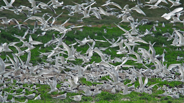
Five familiar waterbirds at the heart of the model
The researchers centred their analysis on five widespread and well-monitored waterbird species: Barnacle Goose, Whooper Swan, Mute Swan, Greylag Goose and Mallard. These species were chosen because they are abundant in Denmark, show strong seasonal movements, and feature prominently in HPAI surveillance data.
Weekly bird numbers were estimated across the entire country using a combination of organised counts and citizen-science records. These data were then fed into a national grid, allowing the model to simulate changes in bird numbers and infection risk across the year.
Water, not direct contact, drives infection
Rather than assuming birds infect one another directly, the study focused on environmental transmission. Infected birds shed virus into water bodies, where it can persist long enough to infect other birds drinking or feeding in the same areas.
This approach proved crucial. The model showed that infection risk rises where large numbers of birds congregate in wetlands and coastal waters, even if they do not remain there for long. It also explains why outbreaks can continue after infected birds have moved on.
Clear seasonal peaks emerge
The simulations revealed a strong seasonal signal. Infection risk increased sharply through winter, peaking in late winter and early spring before declining through summer. Coastal and wetland-rich areas consistently showed the highest risk, while inland and urban areas were far less affected.
These patterns closely matched real-world surveillance data from Denmark, suggesting the model is capturing the underlying processes driving outbreaks in wild birds.
Different species, different roles
Although all five species contributed to transmission, they did so in different ways. Barnacle Geese emerged as the largest contributors to overall mortality during peak outbreak periods, reflecting their abundance and seasonal concentration.
Swans played a particularly important role during winter and early spring, while geese and swans together dominated the predicted summer transmission that is often poorly detected by surveillance. Mallards, while less likely to die from infection, still contributed to environmental contamination by shedding virus.
Dead birds matter more than expected
One of the most striking findings concerns carcasses. Infected dead birds continue to shed virus into the environment, acting as persistent sources of infection.
The model suggests that removing half of infectious carcasses could reduce annual wild-bird mortality by nearly 40 per cent. Removing all carcasses effectively stopped transmission altogether in the simulations, highlighting the potential value - and practical challenges - of targeted carcass removal in high-risk areas.
Why this matters beyond Denmark
While the study focuses on Denmark, its implications extend far wider. Many parts of north-west Europe share similar waterbird communities, migration patterns and wetland landscapes.
The findings underline the importance of focusing surveillance and management effort on coastal and wetland hotspots, particularly during late winter and early spring. They also reinforce the idea that wild birds are not just passive carriers of HPAI, but active participants in complex environmental transmission cycles.
A tool for smarter surveillance
The authors stress that the model is not a prediction of exact outbreak locations, but a way of understanding relative risk. Used alongside field surveillance, it could help authorities decide when, where and which species to prioritise for monitoring.
As HPAI continues to evolve and affect new species, studies like this offer a clearer framework for responding to outbreaks with evidence rather than assumption.
January 2026
Get Breaking Birdnews First
Get all the latest breaking bird news as it happens, download BirdAlertPRO for a 30-day free trial. No payment details required and get exclusive first-time subscriber offers.
Share this story